Back to Table of Contents
4
To next page
Al
Idrisi (1150) (Kitab Ruyar)
(Book of
Roger) written in Sicily
-----------------------------
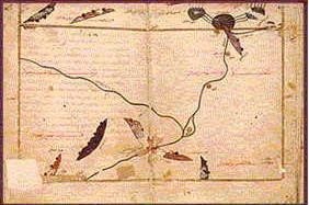
To the left: The sources of the Nile according to Idris (map from the Paris manuscript)
Idrissi Cairo Manuscript; Section VI of (on top) the East African Coast
The island left is Socotra; the island right is Kanbalu. Among the cities on the African coast in this section are from the left: medinat Bazua; Karmua; Merca.


Idrissi Cairo Manuscript; Section VII of (on top) the East African Coast.
The multitude of islands are the islands of the Zang. Some of the towns in this section on the east African coast (on top) are: Baduna; Malinda; Monfasa; al Banis; Bathana.
Abu Abdullah Muhammad al-Idrisi al-Qurtubi al-Hasani as-Sabti, or simply al-Idrisi (1100 – 1165), was an Arab Muslim geographer, cartographer and egyptologist who for some time lived in Palermo, Sicily at the court of King Roger II. Muhammed al-Idrisi was born in Ceuta Spain. He created the Tabula Rogeriana in 1154, one of the most advanced medieval world maps. Officially: his Kitab nuzhat al-mushtaq fi'khtiraq al-'afaq. Translated: A Diversion for the Man Longing to Travel to Far-Off Places. Six of the ten copies of his book contain at the start of the work a circular map of the world which is not mentioned in the text of al-Idris. It is Al-Idrisi's world map from Ali ibn Hasan al-Hufi al-Qasimi's. His book is the most valuable for the 12th century for East Africa.
Taken from: De Goeje: Al Idrise, Description de l'afrique
M. Guillain: Documents sur l'histoire, la geographie
Neville Chittick: East Africa and the Orient.
The original translation by Jaubert
(Kitab Ruyar means book of Roger) (This is Al-Idrisi's geography book named after his employer Roger II of Sicily)
Al-Idrisi did not travel to the lands he described, he collected all information from hear say.
Third section (of the first climate)
P25
In all Nubia, women are of perfect beauty; they have thin lips, small mouths, white teeth, smooth, non-frizzy hair. We find no hair comparable to that of the Nubians in all the lands of the Negroes, nor in the Magzara (1), nor in the land of Ghana, nor among the inhabitants of the Canem (2), nor among the Bodja (3), nor among the Abyssinians, nor among the Zindjes . Moreover, there are no women who are preferable to them for marriage; that is why the price of a slave of this country rises up to 300 denares (4) or so, and it is because of these qualities that the princes of Egypt so desire to possess them, and the buy at very high prices, to make them the mothers of their children, because of the delights of their embraces and their incomparable beauty.
Forth section (of the first climate)
P27
The best known residences and the best known towns are in Nubie, Coucha (6), Alwa (7), Dongola (8), Bilac (9), Soula (10). In Abyssinie, Marcata and An-Nadjagha (11). Among the oasis of the interior in part of upper Egypt, Syene (Oswan) (12), Atfou (13) and Ar-Rodaini (14).
It is in this section that is the place where the Nile splits into two branches, that is to say:
1: The Nile of Egypt who runs through the country from south to north, most of the towns of Egypt are built on the sides and on the islands of the river.
2: The branch that runs from the east, and runs to the far west, it is on that branch of the Nile that you find most of the towns of the Sudan.
One finds in the lake a fish of which the head, has a mouth that resembles that of a bird. There are also other remarkable animals. That lake is situated behind, but very close to the equinox line. On the interior looking part of the lake it receives the water of six rivers. A mountain in the lake separates it nearly into two. The mountain spreads out towards the north west. On the side of that mountain, a branch of the Nile, which runs to the west leaves the lake, and that one is the Nile of the blacks, on the side of it are situated most of the towns of that land. Another arm leaves the lake on the east side of the mountain. This one runs north through Nubia and Egypt and splits in lower Egypt in four branches of which three go into the Mediterranean and the forth in a salt lake that stops close by, meaning at six miles from Alexandria. This last lake is not connected to the sea, but is made by the inundation of the Nile. It stretches over a short extent parallel to the river and we will talk about it then, if God whishes.
P29
Starting from the mountain of the moon, you count, going north after passing the ten rivers and their lakes, to the great lake, 10 days on foot. The size of those two small lakes from east to west, is six days on foot. In that land (10 days wide) that we just described there are three mountains, directed east-west. The first which is closest to the mountain of the moon, was called by the priests of Egypt the mountain of the temple of the images. The second which follows the first towards the north received the name golden mountain because of the gold mines there. The third, next to the second is named together with the land in which it stands, the land of the snakes. The people of the place say that you see there big snakes that kill just because they exist. There are also scorpions, very big, black colored, and instantly deadly when they bide. This is reported by the author of "the book of marvels". Codama (16), the author of "kitab 'l-khizana" says that the Nile from the source till the delta at the Mediterranean is 5634 miles.
(Note: when describing Egypt, he states: The length of the river from its sources to the mouth, if you have to believe several authors, 5434 miles. The author of the Kitabo 'l-Khizana however says it is 4595 miles long.)
P29-32
The length of the river in Nubie is thousand miles after which writes the author of "the book of marvels" the length in the area of Mizr is one third of a thousand miles. In the small lakes, and beyond in the Nile one finds crocodiles. One also finds water-animals called pig which are bigger then the buffalo, who stay close to the Nile, feed of the vegetation that grows there, and go back into the water. One also finds in the Nile fish:
1: a round fish with a red tail called lach, good to eat but hard to find.
2: The abramis: a white fish, round and with a red tail, one says he is the king of the
fishes very good to eat fresh or dried and salted, but is small, as long as the palm of
your hand and one third of that wide.
3: The rai: (salmon) big red fish. There are big and small ones. The big ones are up to
three pound. Good to eat, something like abramis.
4: The bonne (carpe) big fish, great in taste, you find them from about 5 to 10 pounds.
5: The balati, round fish like the afar which one finds in lake Tiberias. There are few
bones in and its tasty, sometimes you find them of 5 pounds.
6: The loutis (latus) the fish one calls farkh (perca) in Egypt, good to eat, very oily, you
can find them, but rarely as heavy as a quintal.
7: The lobais, good to eat, fine taste and does not have , till boiled, the odor of fish. One
uses the fish in the kitchen for many things even as meat. Its meat is solid. There are
big and small ones, even up to ten pounds. All these fish have scales. You can find (in
the Nile) others who don't. Among those are:
8: The samous , a fish with a big head very fat and sometimes about as heavy as a quintal.
One sells him cut in pieces.
9: The ninarial, a long fish, with a mouth like a bird.
10: Om Obaid, fish without scales that has monthly bleedings.
11: The djalbira, fish without scales, a fish of about one pound, poisonous.
12: The chal, a fish who carries on his back a thorn with deadly poison.
13: The ancalis (anguille) fish resembling a snake, and quite poisonous.
14: The djirri, fish with the back black and with a moustache a big head and a small tail.
15: The cafou, round fish wit rough skin used by the women to card flax.
16: The rada: a fish round as a bole, somehow rough, somehow poisonous so that if you
touch it your hand feels sudden pain and you are forced to let go. The fish keeps this
quality as long as it is alive, but when dead, becomes like all other fish.
17: The water dogs. (kilabo'l-ma) who resemble dogs and have different colors.
18: The water horse (faraso'l-ma) who resembles the horse in its appearance but it is
small and has feet as a duck. It contracts them when wanting to lift and opens them
when letting them down. It has a long tail.
19: The sacancour, a kind of crocodile. It is different from the fish in so far as that it has
hands and feet. It is different from the crocodile as it has a sharply pointed tail, where
as the crocodiles is round. Its grease is counted as an aphrodiastic medicine as well
as the salt used to preserve it. The sacancour is nowhere found but in the Nile up
to Syene.
20: The crocodile (timsali) who also does not exist in any other river or sea then the Nile
of Egypt. It has a long head specially shaped so that it is equal to the other half of the
body, the tail is scaled. It has such strong teeth that if it gets a dangerous animal or a
man it is sure it will pull it into the river. It is amphibious, because often it spends a
day and a night on the shore walking on its hands and feet. It is dangerous at land, but
less then in the water where it is really at home. However, the all powerful has made
him an enemy in a little animal between the beasts of the Nile which is called lachk
(ichneumon) which always observes him and the moment he opens the mouth it goes
inside into the intestines and eats his liver and intestines, making him die.. .. ..
Fifth section(of first climate)
Is about Ethiopia
P40
At 8 days of Naketi (17), we find Batta, whose territory touches that of Berbera, a country whose first village is Djowa, which is not very far from Batta.
P42
Abyssinia borders on the sea side with the country of Berbera, which obeys the Abyssinians, and where one finds a large number of villages, the first of which is Djowa. From there to Nacati one counts 6 days; to Batta of the desert 7. The town of Batta, mentioned above, is located beyond the equinoctial line at the end of the inhabited lands.

Section six of the first clime in the Paris manuscript.
P44
This section is the description of, in the south, the towns of Carfouna (18), Markah (19), and el-Nedja (20) .
(On his maps it consists of the regions of barbar below the Habasha as well as Ard Kafarat as Sudan) (Black Pagan Land)
These three countries are the southern end of the dependencies of Berbera, and are situated at the shore of the Yemen sea. The people of Berbera feed themselves for a big part on sea turtles who they call: lebeh.
One can reach Carfouna from Djouah (21) by sea in two days. The land is dominated by a big mountain that stretches south. From Carfouna (18) to Termeh (22) , three days by sea. It is there that starts the mountain of Khakoui, (65)(Ras Hafun) who has seven peaks, really high, and the mountain continues under the water for 44 miles. Close to those peaks are the villages known as d'El Hadye (53) (Somali). From Khakoui to Markah (19) you have by sea three small days and seven over land. Two days from Markah in the desert is a river that floods just like the Nile and on which one sows dourha. From Markah (19) to El-Nedja (20), a day and a half by sea and four by land.
El-Nedja is the last dependency of Berbera. From El-Nedja (20) to Carnuna (18) takes eight days. El Nedja is a small town at the sea shore. From there to Bazuna (23) is six days on foot. It is a sizable village, lots of people. The natives eat frogs, snakes and other animals for which people mostly feel horror. This country borders to that of the Zendj. Carnuna (18) and Bazuna (23) are pagan, their territory touches that of the Zendj along the coast. This hole area has opposite it to the north Yemen, from which it is separated by a sea arm of about 600 miles wide but depending on the depth of the gulfs into the interior and the penetration of the capes into the sea.
P46
In this section are also four islands two of whom on the East Side in the gulf of the Weeds and called Khartan and Merian. (the twin islands of Khuriyan and Muriyan or Kuria Muria) The third is Socotra, (On his map Idris gives the following coordinates for Soqotra latitute11 deg, longitude 72 deg.) known through the aloes that it produces, and at two days by boat with good wind. Opposite this island on the coast of Yemen is the town of Berbat (Merbat) and Hasek (26) about which we will still talk, God wishes. The fourth island is called Cabala (24) (Quanbala he places it close to Socotra). It is found to the west of that deserted section (juz) It is uninhabited but thickly wooded, with rugged mountain chains, various species of wild and dangerous animals, as well as a waterfall which falls into the sea. Sometimes boats carried away (akhrama) from Yemen or vessels from Qulzum (or Colzqoum) or Abyssinia put into this island seeking refuge. It is opposite the strong point called Mikhlaf Hakem on the coast of Yemen.. .. ..
P47
About the island of Socotra, it is big, well known and covered with trees. It's best known vegetable product is the tree that produces aloes, and nowhere exists, nor in the Hadramout (27) nor in the Yemen, nor in the Sahar (28), and nowhere else, aloes that comes in beauty close to that of Socotra. This island is as we have said from the north and west side close to the province of Yemen from which it is a dependency and a resemblance Confronting it on the Bilad az Zanj side are towns of Malindi and Mombasa (29). Most of the people on the island of Socotra are Christians.. .. ..
P51
The town of Aden is small, but very well known because of its harbor from where the boots leave for Sind, India, and China. One brings from these countries the following: iron, damascened swords, skins, musk, aloes wood, saddles, pepper, coconuts, perfumes.. .. ebony wood, tortoise shell, camphor, nutmeg,.. .. elephant tusks,.. .. and also most of the aloes for trade.

Section 7 of the first clime from the Paris manuscript
P55
This section consists of the description of a part of the Indian sea and all the Islands that are in it, in which people of different races live. In the south of the countries in this section is the rest of the countries of the black kaffirs, and several countries close to the sea. Our intention is to describe all those things with clarity. So we say that that sea is the Indian Sea and on its shore is situated the town of Bedouna (23), at the extremity of the country of the kaffirs, unbelievers who have no revealed religion, but take standing stones (al-ahjar al-qaina) which they anoint with fish oil and to which they prostrate themselves in worship. That high is the stupidity in which these people live and the absurdity of their believes. Part of this country obeys the Berber king the rest the Ethiopian one.
From Bedouna (23), on the coast to Medounat (25) is three days. This last town is in ruins, nearly deserted, dirty and difficult to live in. The peoples live from fish, shells, frogs, snakes, rats, lizards, and other horrible reptiles. These people practice fishing without boats, but they do not keep to the beach either. They swim with little home made nets of vegetable fibers attached to their feed. Through lines with nods that they keep in their hands they close the nets as soon as they feel that the fish got in it and that with an art in which they excel and with tricks in which they have a long experience. To attract the fish, they use common reptiles. Although they live in problems and big poverty, these people, God likes those who live a homely live, are satisfied with their lives and what they have. They obey the Zendj government.
P56-57
From Medounat (Maqdishu?)to Mulanda (M.l.n.da)(Malindi or Manda), one follows the coast for 3 nights and 3 days (by boat). Mulanda, a town of the Zenj is situated on the edge of the sea at the mouth of a river of sweet water. ( Today Malindi is 4 miles south of the Sabaki river, some authors name Gedi as the original Malindi). It is a large town in which the inhabitants engage in hunting and fishing. On the land they hunt tigers and other ferocious animals. They obtain various kinds of fish from the sea, which they cure and sell. They possess and exploit iron mines, this is for them an object of commerce and the source of their greatest profits. In the town there are maqanqa (or El-Mocnefa) (sorcerers). They pretend to know the art of enchanting the most venomous snakes to the point of making them harmless for everyone except those they which to harm. They also pretend they can enchant lions and tigers so that they can not harm them.
It is a two days journey along the coast (by boat) to Manfisa (30). This is a small place and a dependency of the Zenj. The inhabitants of this place work in iron mines and hunt tigers. They have red colored dogs that fight every kind of wild beast and even lions. Manfisa (30) is on the sea shore opposite the mouth of a great river up which it is possible to sail for two days. Its banks are uninhabited because of the wild beasts that live in the forests were the Zanj go to hunt, as we have already said.
The king of Zanjibar lives in Mafisa (30). His guards go on foot because they have no mounts: horses can not live here.
From Manfisa (30) to the village of El'Banas (61) on foot, six days, and by sea one and a half days. El-Banas (31) (61)is a very big and heavily populated place. A one-sided drum called Er-rahim (Er-radjim) (32) and big as (unreadable) is worshiped in El-banas. The drum is covered with leather on one side, on which a cord is attached to beat the drum. It makes a terrible sound that can be heard 3 miles away.
Banas (31) is the last Zenj dependency (which) borders on Sofala, the gold country. From El-Banas (31) (61), on the coast to the town called Tohnet (Al-Tuhnat) by sea, one and a half days, and overland eight days, because in between there is a great golf who stretches to the south and so forces the travelers to go around, and also a high mountain called Adjoud (33) (61) from which the sides have been eroded by the water which hits it with great noise. This mountain attracts to it all boats that come close and sailors keep far from it. (63)(66)
The town of Tohnet is part of the country of Sofala and touches the country of the Zendj. There are many villages, all of them on the boards of the rivers. In the whole of Zendj country the main products are iron and the hides of tigers from Zanzibar. The color of those hides is close to red, and they are very soft. Since they have no pack animals, they themselves transport their loads. They carry their goods on their heads to two towns, Mombassa and Malindi. There they sell and buy. The Zanj have no ships in which they can voyage, but boats land in their country from Oman, as do others that are going to Zabaj (34)(or Djawaga) (Endonezya). These foreigners sell their goods there, and buy the produce of the country. The inhabitants of Zabaj (34)(or Djawaga) call at Zanj in both large and small ships (zawariq wa marakib kubar) and trade their merchandise with them, as they understand each other's language. The Zendj have at the bottom of their hearts a great respect for the Arabs. For this reason, when they see an Arab, whether a traveler or merchants they prostrate themselves before him. They say in their language: Welcome son of Yemen. The visitors to this country steal their children, enticing them away by means of giving them fruit. They carry the children from place to place and finally take possession of them and carry them off to their own country (64). Because the people of Zangibar or numerous and are short on food. The ruler from the island of Qais (35)(or Keish) in the sea of Oman (opposite Muscat (36), the port that became important after the decline of Siraf) had 505 ships with which he used to raid the Zanj coast for slaves and he makes many captives.
P59
Opposite the Zanj coast are the Zaledj islands (37); they are numerous and vast; their inhabitants are very dark in color, and everything that is cultivated there, dorrha, sorghum, sugar-cane and camphor trees, is black in color. Among the number of the islands is Sribuza (38)(40)(Jazirat Sharbua min az zanj) which is said to be 1,200 miles round; and pearl fisheries and various kind of aromatic plants and perfumes are to be found there, which attract the merchants.
(on the map the island is situated right off mount Naked (Jabal Ajrad) between al Banas (31) and Tohnet)
(On his map two islands have the inscription : an island belonging to the Zanj.)
Among the islands of Zaledj (37) included in the present section is Andjuba (39) (40) (Anjouan-Johanna), whose principal town is called Unguja (El Anfoudja) in the Zanj language, and whose people, although mixed, are actually mostly Muslims. The distance from it to Banas (31) (61) on the Zanj coast is one majra (42) . The island is 400 miles round; bananas are the chief food. There are five kinds, as follows: the bananas called kundi; fili whose weight is sometimes twelve ounces; omani, muriani, sukari. It is a healthy, sweet and pleasant food. The island is traversed by a mountain called Wabra. The vagabonds who are expelled from the town flee there, and form a brave and numerous company which frequently infests the surrounding of the town, and who live at the top of the mountain in a state of defense against the ruler of the island. They are courageous, and feared for their arms and their number.
The island is very populous; there are many villages and cattle. Another translation reads; the island has many buildings linked together. They grow rice. There is a great trade in it, and each year various products and goods are brought for exchange and consumption. In the past when India was in confusion, the Chinese, transferred their trade to the islands of Zanedj or Zaledj, and the islands that depend from it, facing the coast of the Zinj, where they came to intimate relations (ishra) with the inhabitants on account of their mildness and accommodating ways. It is because of that that this island is so populated and receives so many visitors.
Close to that island there is another one, not so big, Jazirat min az Zanj, with Jabal an-Nar dominated by a big mountain, of which the sides and top are inaccessible, because everybody getting close is burned. (this island is without doubt La Grande Comore) (40) (62). During the day there is a dense fog, and during the night a heavy fire. From its base springs water, some cold and sweet the others hot and salt.
Close to the above island of Zanedj or Zaledj (37) ( Jazirat min az Zanj ) one finds another called Kermedet (40) (43) on which the people are black. They are called Nerhin (43). They wear the dress called Azar and the Fouta (44). They are fierce people, brave, and always walking armed (41). Sometimes they get into their boats and attack merchant ships, of which they take all merchandise. Only their own countrymen they leave to go home, they do not fear any enemies. It is separated from Sahil az Zanj by a majra (42) of a day and a night. Between it and the island of El-Anfrandji (40) is a majra of a day. At a distance of about 3 miles from this island, and two short days from the continent that touches Abyssinia is the Island of the Monkeys (40) (45) ……………The people of the two islands Khartan and Martan use different tricks against these monkeys, catch them, and transport them to Yemen, where they sell at high price. The people of this province ( I mean the merchants of Yemen) use them as slaves to guard their belongings and money in their shops………………To the north of Monkey Island is an island called el-Cotroba (40). It is flourishing and inhabited by a Christian tribe, which has however retained Arab customs, who speak Arabic, and claim to be from this nation. They are very enterprising and very brave people. They attack ships coming and going around Bahrain, Basra and as far as Oman.…………….

Section 8 of the first clime of the Paris manuscript
P65
(At the south end of Pemba began the Sofala country) (Art Sufala) (Sufala is used to mean shoal water, sometimes however it means lowland)
This section embraces the description of the remainder of the country of Sofala.
You first find two towns or better two big villages, in-between there are villages and camps that resemble those of the Arabs. Those big villages are called Djantama (46) and Dandama (47) (Chindi and Quilimane?) They are situated at the sea shore and rather small. The inhabitants are poor, miserable, and without resources to support them except iron, of this metal there are numerous mines in the mountains of Sofala. People of the Zabag (or Zanedj or Raneh) come hither for iron, which they carry to the continent and islands of India where they sell it for good money, because it is an object of big trade and it has a huge market in India. For although there is good quality iron in the islands and in the mines of that country, it does not equal the iron of Sofala for its quality and its malleability. The Indians are masters in the arts of working it. They prepare and mix the substances so that through fusion one gets the soft steel normally called: India steel. They have factories that make the best swords in the world. This is how in iron Sind, Serenbid (48) and Yemen rival among each other in quality through local circumstances, as well as the art of manufacturing, the pouring of the steel, the smelting, and the beauty of the polished surface. But nothing cuts better then this iron from India. Everybody knows that and nobody can deny it.
From Djantama (46) to Dandama (47) is two days by sea and seven by land. Dandama is one of the important towns of Sofala. Three more are close to its territory. One of them is Sayuna (49). Sayuna, (a settlement at the mouth of the Zambezi?) is medium in size and its inhabitants are a collection of people of Hind, Zunuj (Zanj) and others. The town is situated on an estuary (khor) (another translation reads: gulf) into which the ships of the voyagers can enter. (One of the Manuscripts has added here:) (It is here that the ruler lives, he has soldiers, but there are no horses in the country.) From it to the town of Bukha along the coast (al as sahil) is three majras (42). Also from Sayuna (49) to Dandama (47), of Sofala towards the west, by sea, three days, and by land about 20 days (marhala) . Because in between there is a large gulf, extending south, which forces to go around it. From Bukha to Djantama ( this is a mistake it should read Jabasta) by sea one day, four days overland. In the whole country of Sofala one can find gold, in abundance and from excellent quality. But the people like more copper, and they make jewelry from that metal. The gold one finds in Sofale is more, in quality and volume, then that from other countries, because one can find pieces of about one or two mitqals (50) sometimes even of a rotl. (51) They melt it in the desert, in a fire of cattle dung, and it is not necessary to use mercury for this, like it is done in west Africa because the people of this last country united their pieces of gold and mix it with mercury..... putting the mix to fusion by means of fire from coal, in a way that the mercury evaporates, and there remains only the pieces of gold melted and pure.
The gold of Sofale does not need that process, but it is melted without chemicals. We will end herewith what we have to say about this country, if it pleases God. To this section belong the islands indicated in their place, and among others those called el-Roibahat, (or Dibadjat = Maldives) which are very close to one another, and innumerable. Most of these islands are deserted. However, the largest of these, named Abuna (52), is flourishing and populated by a large number of inhabitants who cultivate it and who also cultivate the most considerable of the surrounding islands. They are located in the neighborhood of the island of Comor. All the inhabitants of these islands are subject to the domination of a leader who gathers them together, protects them and defends them as much as he can. It is his wife who does justice and speaks to the public without being veiled, according to a constant custom of which one never departs. The name of this queen is Demhera. She wears ornaments of gold, and on her head a crown of the same metal, enriched with pearls and precious stones. She wears gold boots, and no one else can wear any shoes, on pain of having her feet cut off. This queen, on occasions and solemn feasts, appears in public, as well as the girls of her suite, with a large apparatus of elephants, trumpets, and flags. Her husband and the viziers follow her at a certain distance. This queen has riches that she holds in vaults, to distribute them to the poor of his states. None of these alms are given without it being in his presence and under her eyes. The inhabitants of the country are in the habit of suspending silk fabrics on his way and on the places of her passage, because it has a lot of magnificence, as we have explained. The king and queen of these islands live on the island of Anbariya. The main production of these islands is the named tortoiseshell called Zabt, which can be divided into seven pieces, four of which weigh a mine, that is 260 drachmas (54). The heaviest weigh a half-mine each. It is with this shell that they make various ornaments for women's adornments and combs, since it is thick, transparent and well varied in its colors.
The women of this island go their head uncovered, wear braided hair, and each of them employs ten combs in her hairstyle, more or less; it is their main ornament, the same as among the women of the Cloud Islands, whose inhabitants are without religious belief, as we will say below.
The islands known as Dibadjat (or Roibahat = Maldives) are populated. They grow coconut and sugar cane. Trade is done by using shells. They are distant from each other about six miles. Their king keeps the shells (cauris) in his treasure, and it is he who has the most. The inhabitants are industrious, clever and intelligent.
They make very wide tunics, opened from above and fitted with pockets. They build ships with very thin pieces of wood; the most remarkable of their houses and their buildings are in very hard stones, but they also use to the construction of their homes, woods that arrived by water and sometimes even fragrant woods .
It is said that the marine shells of which the royal treasury is composed are on the surface of the waters in calm weather. They throw in the sea pieces of coconut wood, and the shell attaches to this wood. It is called el-kendj. In some of these islands we find a substance resembling a pitch-liquid resin, which burns the fish in the bottom of the water, and which is extinguished on its surface. The last of these islands touches that of Serendib, By one of its highest sides, in the sea named Herkend (55). The island named Komor is distant from the Dadbadjat Islands from seven days of navigation. This last island is long. His king remains in the city of Malay. The inhabitants say that it extends in length over a four-month period [of walking] to the East. It begins near the Dibadjat Islands and ends in front of China's islands on the north side. The king of this country is not surrounded nor served, either for drinking or for eating, then by young men prostitutes, dressed in precious fabrics silk fabrics of China and Persia, and wearing gold bracelets on the right arm. These bracelets, in the language of India, are called tanfouk prostitutes, tanbabeh. In this country, they marry men instead of women.
These, during the day, serve the king, and at night they return to their wifes. In this island is grown grain, coconut tree, sugar cane, betel. This last plant is the one that grows the most abundantly on the island. Betel is a plant whose stem is similar to that of the vine; she is climbing and attaches to nearby trees. Leaf looks like the dand but is thinner; taste in is acre (hot) like that of clove. Whoever wants to chew it takes quicklime kneaded with water, and mixes it with each leaf in the proportion of a quarter of dirham (56). It can only be used in this way; that who chews it tastes like sugar, and his breath makes a pleasant scent. This use is known in the lands of India and in neighboring areas.
On this island [Komor] is made fabrics with a grass whose vegetation resembles that of papyrus. This one is the kartas, so called because the inhabitants of Egypt use it to make paper. The workers take the best part (of this herb), and use it to manufacture fabrics comparable in beauty to the colored silk stuffs. These fabrics are transported to all other parts of India, sometimes even in Yemen, where they serve as clothing. Travelers report having seen considerable quantities in the latter country. They also manufacture in this island admirable white mats adorned with paintings (or drawings). The considerable people have them spread in their homes in place of silk carpets and others. In this island is growing a tree called el-bel which is a palm tree variety doum, and under which ten people can put themselves in the shade. He also takes ships from this island named mechiat, similar to ghazwaniyya solidly constructed, long sixty cubits, made of a single piece [of wood], and to contain one hundred and fifty men. A modern traveler tells that he saw, in this country, a table made of a single piece of wood and around which two hundred people would eat. There are woods in this island that we do not see there are no similar ones elsewhere. The inhabitants are white, barely bus, they look like Turks, and are reported to be of Turkish origin.
P73
(The king of Serendib) They bring him wines from Irak and Fars, that he buys using his money and sells it in his states; for he drinks wine and defends licentiousness, while the kings of India allow libertinage and prohibit the use of intoxicating liqueurs, with the exception, however, of the King of Comar, who defends one and the other.

Section 9 of the first clime of the Paris manuscript
P78-79
We have said that in the south of this sea is a part of Sofala, of which we have already talked, and that among the habited places is the town of Jabasta, not so big. There is quiet some gold, its exploitation is the only industry and the only income for its people. They eat sea turtles and shells, there is not much dhorra (sorghum) among them. The town is situated in a big gulf where the boats can enter. The people of Jabasta who do not have boats or beasts of burden to carry their loads, are forced to carry their loads themselves, and to help out each other in this. Also people from Qumr (Madagascar) and merchants of the land of the Mihraj (ruler of Sumatran empire of Sri Vijaya) are well received ( in Jabasta of Sofala) and carry on trade there. From the town of Jabasta to the town of Daghuta (57) by sea is a journey of three days and nights, and from it (Jabasta) to the island of Qumr is one majra. (42)
The last town on the coast of Sofale (Sufalat at tibr) is Daghuta (57) (Angoche in Mozambique?) and its territory, and there most gold is found. It is in a big gulf, the people are naked. They cover with their hand their sexual parts when merchants come to them from neighboring islands. The women are afraid and never show themselves in the markets nor in the places of business, because of their nakedness. That is why they are confined to their homes. One finds more gold in these territories then anywhere in Sofala. This land touches on that of the Quac-Quac (58), where there are two miserable, dirty towns. This is because of the scarceness of food and scarceness of all other things to. One is called Derou (or Zaoura, this last name comes close to the river Zavora, in that neighborhood) and the other Nebhena or Iana'ana (what comes close to modern Inhambane). In its neighborhood is a big village called Dargha or Daghdagha (59), the natives are black, with hideous figures, a deformed complexion: their language is a kind of whistling (59). They are absolutely naked, and little visited by foreigners. They live of fish, shells, and turtles.
They are (as we have said) neighbors of the island of Wacwac, of which we shall speak later, God willing. All of these countries and islands are situated in a large gulf. Neither gold, nor ships, nor commerce, nor beasts of burden are found there. As for the island of Djalous, its inhabitants are Zendjes; they live, as we have said, from anything that falls into their hands. In the island is a mountain, whose soil is mixed with silver. If one approaches this soil with fire, it dissolves and becomes silver…..
P83
From Tiyuma (67) to Komor (68) Island five days. The aloe wood that produces this last island is good; but the one we call sanfi is even better. There is sandalwood in Tiyuma and rice; the inhabitants wear the garment named fouta: they welcome and honor foreign merchants. Those are men who are righteous, pure, and renowned for their benevolence and perfect fairness. They worship idols and Buddhas, and they burn their deaths. The island of Senf (60) is near the island of Komor; there only three miles apart. Senf (60) is home to aloe wood superior to that of Komor, because, immersed in water, it does not float, it is so heavy and excellent.
Section ten ( of the first climate)
P101
The people that live in the first climate are swarthy, others black. In the first case you have the people of India, Sind, China and the coasts. As to those who live in the deserts of Zenghebar, Abyssinie, Nubie, Soudan, and of whom we have already spoken, those because of the lack of the moisture of the sea, and because of the intensity of the heat of the sunlight to which they are constantly exposed; those we say have all kinky hair, black skin, stinking sweat, the skinon the legs that is dried out, a deformed body, little industry and small intelligence. They live in extreme ignorance and it is under that title that they are known. There are among them no scholars, and all what their kings know about justice and government, they learnt it from people coming from the third and fourth climate, who had read the history of the ancient kings. Among the animals found here in the first climate and not in the six others are the elephant, rhinoceros, the giraffe, monkey with tail…….
Section six ( of the second climate)
P152
There exists in the centre of the Persian Gulf opposite Muscat an island called Keich, square in form 12 miles long, of which a certain governor of Yemen took possession. He fortified it, he populated it and equips it with a fleet, and with that he takes control of the coasts of Yemen. That man makes travelers and merchants lose lots of money, steels everything of everybody, and he damages the trade so that it turns from Oman to Aden. With his fleet he destroys the coasts of Zendj, and the ones of Gamran. The people of India are afraid of him and resist him with ships called el-mechiat, about which we have already spoken….. This man up to today continues his predatory expeditions, he is very rich, and nobody can stop him.
Section seven ( of the second climate)
P173
The name of Belhara means king of kings and is inherited here, just like in other parts of India, where when a king ascends the throne, he takes the name of his predecessor and transfers him to his heir. This is an established costume which the people never change. It is also like this among the Nubie, the Zendj, the Ghana and the Persians and in the Roman empire…..
(1) Magzara; literally: massacre
(2) Canem; Kanem in West Africa.
(3) Bodja: Beja people from Sudan. The Egyptians leaving from Aswan; the southern border town on the Nile; have to cross their territory to reach the harbours on the Red Sea.
(4) Denares; Dinars: gold coin of one mithqal (4-5 gr of gold)
(5) Tadjowin: nomadic black pagan people living close to Nubia.
(6) Coucha: Kush: kingdom in Sudan on the Nile.
(7) land of Alwa: northeast of the merging of the White Nile and the Bleu Nile; was a medieval kingdom in what is now central and southern Sudan. Found in Al Khwarizmi (847); Suhrab (945); Ibn al-Fakih al Hamadhani (903); al-Zayyat (1058); Idrisi (1150); Wasif Shah (1209); Ibn Said (1250); Al-Dimashqi (1325); Ibn al-Dawadari (1335); Ibn Abd’essalam al-Menoufi (15th).
(8) Dongola: Old Dongola is a deserted town in what is now Northern State, Sudan.
(9) Bilac; or Boulac ??
(10) Soula; The edition of Dozy and De Goeje has: maybe an error for Nowabia or Nowaba; the town from which Nubia got its name.
(11) An-Nadjagha: Nedjachy or Najashi; was the ruler of the Kingdom of Aksum who reigned from 614–631 CE. He gave shelter to the Muslim emigrants around 615–616 at Axum.
(12) Syene (Oswan): present-day Aswan.
(13) Atfou: also found in Yakut
(14) Ar-Rodaini: also found in Abulfeda
(15) Terma: this is the translation of the edition of Dozy and De Goeje. Jaubert has Tarfi.
(16) Codama, the author of "kitab 'l-khizana": see my webpage Qadama (930); the book should be Kitab al Kharadj.
(17) Naketi: in a different manuscript: Bacati.
(18) Carfouna: Guardafui (according to Jaubert). Qarfuwa; ( from Al Idris ; Ouns al Moubhadj (1192)); the Carfouna or Karmua from Idrisi (1150); Ibn Said (1250): Serfouna or Carfouna (or Qarquna/Farfuna). However: Charles Guillain: The mountain: Djabal-Yerd’foun is resembling Carfouna if you look at the ways it is written in the different manuscripts: Carcouna and Serfouna and Yerd’foun. He proposes Carfouna and Khafouni = Yerd’foun and Hhafoun. Or: although Guardafui and Ras Hafun are different places (but close to each other) (a variation of) the same word is used.
Carnuna: Jaubert has by mistake also translated Carnuna as Carfouna.
(19) Markah: Present-day Merca is a harbour on the coast of south Somalia. There is indeed a river the Shabelle. Here placed way to far north; identification unsure.
(20) el-Nedja: (according to Marcel Devic p66.) the country of Ajam in north Somalia. Literally meaning Ajam =foreign. Other more recent authors make it Ras Cabad on the South Somali coast. al-Nuga: from Al-Idris Ouns al Moubhadj (1192); Yakut 1220: Nujah (or Nudschah). The Bedje of Abulfida 1331; Naja of al Saghani (1252).
(21) Djouah: Bandel d’Agoa (according to Jaubert).
(22) Termeh: Ras Terma is also known as Ras Beilul, Ras Darma, Eritrea. Here there is confusion as it is situated towards the Red Sea from Carfouna while all other places that are mentioned after are further south the African coast. See Charles Guillain p 192. Ibn Said (1250) and Abulfida (1331) and Idrisi in Ouns al Moubhadj (1192) writes Berma or Barma (Charles Guillain p 238) (Marcel Devic p 57).
(23) Bedouna (is Barawa?): Brawa is a harbour is south Somalia. However in: The Arab Geographers and the East African Coast by J. Spencer Trimingham p 127 it is noted: On his map Idrisi began Ard az-Zanj with Baduna. I (=Trimingham) have suggested that this be distinguished from a nearby pagan town with a similar sounding name (=Barawa), and that it may be the later Maqdishu which changed its name with the revival under the Banu Majid shortly after 1159. (= on the arrival of the Banu Majid see my webpage Ibn-al Mujawir(1232)).
Bazuna: Jaubert has by mistake also translated Bazuna as Bedouna.
(24) Cabala also Qanbela: the "Qanbalu" of Jahiz (d869) en Masudi (916) and many others after them. The days that it was the slave-trade center of East-Africa are far gone; by now the geographers do not know it anymore. Idrisi (1150) describes it as deserted. Ibn Said (1250): It used to be prosperous but is now derelict. Abulfida (1331): it is now in ruins.
(25) Bedouna, on the coast to Medounat : another manuscript has Beroua and Nedouba still another: Berouat and Bedouna. (Charles Guillain p 204)
(26) Hasek: Hasek area on the coast of southern Oman near Salalah.
(27) Hadramout: province in Yemen.
(28) Sahar: according to Jaubert a mistake should be Chedjer; the area east of Hadramout.
(29) Malindi and Mombasa: two towns on the coast of Kenya. If one follows the itinarary of Idrissi along the coast the distances gives point more to Malindi
(M.l.n.da) being Manda.
(30) Manfisa: Mafia island in Tanzania; or the Mefasa: desert or dangerous place from Abulfida 1331. Jaubert in a footnote of his translation adds that two
manuscripts actually have Mombasa. There is very little difference in the way to write the two words. Jaubert actualy has Manisa; this is made into Manfisa by some according to who
the name of this town is a mix up of Mombassa and Mafia in one and the same location. It being on a river fit for navigation is like Mafia opposite the Rufiji. And
the part between Mombassa and Mafia is non existing in the book of Idrisi. In fact the part left out in Idrisi's book is from Dar es Salaam up to Mozambique Island.
(31) El'Banas of Idrisi (1150): Bais with Abd-el-Mo'al (15th?); Al-Bais of Al Umari (1349); Al Himyari: Banas; Ibn Said (1250): Banyna; Abulfida (1331): Batyna.
(32) drum called Er-rahim (Er-radjim) : Al Himyari (1461) has a drum Kalptip.
(33) Adjoud: Marcel Devic p 76 prefers Adjarrad because that means in arab: screaming (because of the waves hitting the mountain). Idrisi (1150): Banas, mountain Adjoud are the same as Ibn Said (1250): Banyna, mountain Ajrad; Abulfida (1331): west of Batyna is Adjued.
(34) Zabaj (or Djawaga) : one of the main islands of Indonesia (Sumatra).
(35) Qais (or Keish) Qays: Qeys Island, also spelled Qais, Persian Jazireh-ye Qeys, island in the Persian Gulf, lying about 10 miles (16 km) off mainland Iran.
(36) Muscat: Oman’s port capital, sits on the Gulf of Oman surrounded by mountains and desert.
(37) Zaledj: This should be Zenoudj according to Charles Guillain p216. Meaning of the Zanj; and the inscriptions on the islands in the maps prove him right.
(38) Sribuza (Jazirat Sharbua min az zanj): another manuscript has: Saranda. (Charles Guillain p216); translated: the island of Sharbua of the Zanj. This according to Charles Guillain p220 is not an island of the Zanj or Madagascar as the list of products it exports resembles Sri Lanka. He adds that Idrisi describes Serendib under the name Seranda while other manuscripts use this Seranda to indicate Cherboua (Sribuza). More modern translations make it one of the Comoros.
(39) Andjuba (Anjouan-Johanna), Unguja (El Anfoudja); Lunjuya (Unguja) = Zanzibar. According to Marcel Devic; Anggoudja is the Swahili word for ‘wait’, what makes it for him a waiting place for ships. The modern word in Swahili is ‘ngoja’ but the pronunciation remains unchanged. Dimashqi 1325 speaks a lot about Anfoudja; for him it’s a huge nearly deserted island.
El-Andjebeh (Andjuba): it is to this island that the Chinese (= here Austronesians) bring their trade. As its capital is Unguja the local name for Zanzibar and the people are of mixed race and Muslim. What we have here is a mix up of the Maldives, Comores, and islands on the East African Coast.
(40) The islands of Cotria, El-Qeroud, Kermouah, Beukan, Serira and Anfoudja found in Ibn Said’s work are the places: Cotroba, El-Qeroud (island of Monkeys), Kermedet (Kahua or Karmaba), the unnamed island (has Volcano; Grande Comoro), Cherboua (Sribuza or Sharbua) and El-Andjebeh ( Andjuba or Anjouan) of Al Idrisi. (on this see: Documents sur l'histoire, la géographie et le commerce de l'Afrique ... By Charles GUILLAIN p 271)
On three of these islands: Kermedet (Kahua or Karmaba), the unnamed island (has Volcano), and El-Andjebeh ( Andjuba ) Gill Shepherd (The Making of the Swahili: A View From the Southern End Paideuma, 1982) has the following to say: These islands are according to Idrisi opposite the Zanj coast and depend (economically) upon the Indies. These are clearly identifiable as the Comoros, being Nzwani (Anjouan, = Andjuba), Ngazija (Grande Comoro, = has Volcano) and Maore (Mayotte, = Kahua or Karmaba). They are described as neighbours. (he then gives their distances to the Zanj places as prove). Cherboua (Sribuza or Sharbua) might Moheli.
(41) A different translation:
Near this island of Javaga lies Kumura Island [Madagascar]. Its inhabitants are black and are called al-buqiyyin. They wear loincloths and cotton capes. They are wicked and aggressive people ...; using their boats, they often attack merchant ships, looting their cargoes and food and preventing their passengers from disembarking. (Viré 1984: 22–23) The name al-buqiyyīn is connected to the name Buki given to Madagascar and its inhabitants by the Arabs and the Swahili.
(42) Majra: a day's sail (including night) was reckoned to be 100 Arab miles (1920m).
(43) Kermedet on which the people are black. They are called Nerhin. Charles Guillain p 218: another manuscript has Kermedet and Nerhin another: Karnoa and Boumin another: Kermehet and El-Boumin.
(44) Fouta: futa: garment; untailored long piece of cloth.
(45) island of the monkeys: Ibn Said (1250); Qadi Ibn Sasri Al-Shafi’I (1300); Al Marvazi (1120) mentions Aden, where female apes were offered for sale to visitors who could not afford to buy slave girls, Al Maqrizi (1441) copied by Abu al-Mahasin (1441) and Al-Sakhawi (d1497) describes this same behaviour of the monkeys in the towns of East Africa, from where the monkeys supposedly were imported to Aden.). Al-Idrisi (1150) and Ibn Al Wardi (1456) has the merchants of Yemen use them as slaves to guard their belongings and money in their shops.
(46) Djantama: another copy of the manuscript has Djesta.
(47) Dendemes, Dendemeh; Dandama: East African people living in the interior, close to the sources of the Nile; also mentioned by Al Masudi (916); Al Idrisi (1150); Ibn Said (1250); Ibn al Jawzi (1257); Harrani (1300); Qadi Ibn Sasri Al-Shafi’I (1300); Al-Dimashqi (1325); Abulfida (1331); Nuwayri (1333); Cowar el-aqalim (1347); Said Abd al Aziz al Dairini (d1385); Ibn Khaldun (1406); Al Qalqashandi (d1418) and Ibn al Wardi (1456) speaks about Demadam; al Himyari (1461).
(48) Serenbid; Serenadeb: Serendib in Sumatra.
(49) Sayuna; Sayouna; Siyuna: also found in Al Idrisi (1150); Al Himyari (1461); Ibn Said al Maghribi (1250); Abulfida (1331). According to Marcel Devic p 84 it might be the modern Sena on the Zambezi river.
(50) Mitqals: about 5gr of gold.
(51) Rotl: varying in different regions from about 0.45kg to 2.25 kg.
(52) Abuna island; another manuscript has Anberia (Anbariya) of which Jaubert thinks it is the correct writing. Harry Charles Purvis Bell in his book Excerpta Máldiviana; links this name and the description of the island to the Henveru Avaru mosque area on Male island (capital Maldives).
(53) El Hadye: Hawiya: In south Somalia mentioned by Ibn Said (1250); Ahmad ibn Al Harrani (1300); Al Idris Ouns al Moubhadj (1192); Idrisi (1150) has El Hadye; Abulfida (1331); Haouiya; Dimashqi (1325) Hawiah; Al Wardi (1456) Haouina.
The reference in Al-Idrisi (1150) to the Hadiye and in Ibn Sa’id (1250) to the Hawiye, on both occasions associated with the Benadir port of Merca, where the Hawiya live today, suggests that they have been in this area for at least 700 years. The references slightly later in the Futuh al-Habasha to Somali groups in north-western Somaliland indicates that the population in this area has also remained substantially unchanged since the sixteenth century, when the work was written. The Galla another group from the Horn has been living there at least since the 15th century as Fra Mauro (1459) mentions a Galla River in Ethiopia.
(54) drachmas: in India called Dramma; based on the Greek Drachma of Alexander the Great lasted as a silver coin for 1500 years.
(55) Herkend; sea of Harkant: the ocean on the east coast of India.
(56) dirham: silver coin of the Arab world (3 gr of silver).
(57) Daghuta: (east africa): found in Ibn Sida (1066); Idrisi (1150); Ibn Said (1250); Ibn Manzur (1290); Qadi Ibn Sasri Al-Shafi’I (1300); Al-Dimashqi (1325); Abulfida (1331); Al Himyari (1461) has Daghwata. Here it has two rivers, is situated besides the land of the Zanj close to Qumr, at the end of the mountain-chain Ousthiqoun; a town also called Dahna which according to Ptolemy is south of the equator (says Al-Dimashqi (1325)). Mayby the same place as: Dgo: Dgaop; found in: Al-Khalil ibn Ahmad al-Farahidi (d791); al-Sahib ibn Abbad (995). In idrisi (1150) Daghuta it is the furthest south town in the land of Sofala. Sofala was one of the earliest places to be visited by Muslim traders for its gold; together with Qanbalu (Pemba) for its slaves.
(58) Quac-Quac: Waqwaq: in the books three different places are called Waqwaq: in South-East Africa; in Indonesia; around Japan. Here East Africa is meant.
(59) Dargha or Daghdagha: the Daghraghatan of Al Himyari (1461). The natives are black, with hideous figures, a deformed complexion: their language is a kind of whistling: the language of the Pygmies.
(60) Senf: old kingdom of Champa on the southeast Asia peninsula.
(61) Idrisi (1150): Banas, mountain Adjoud are the same as Ibn Said (1250): Banyna, mountain Ajrad; Abulfida (1331): west of Batyna is Adjued.
(62) Al Idrisi (1150); Jazirat min az Zanj, with Jabal an-Nar: with a volcano; Ibn Said al Maghribi (1250) island of the Vulcan (Djeziret-el-Beurkan); Al Qazwini (1283) puts the volcano on : The island Eddanda (or Ed-Douda)(island of the loud noise); Qadi Ibn Sasri Al-Shafi’I (1300); Nuwayri (1333).
(63) Idrisi (1150) as well as Ibn Said (1250) do not have any knowledge of the northern part of Mozambique.
(64) Other authors writing on enslaving (children): Tuan Ch'eng-Shih (863); Jahiz: Sudan (869); Abu Zaid al Hassan (916); Hamza ibn-'Ali ibn-Ahmad (1017); Marvazi (1120); Mudjmal al -Tawarikh wa-l-qisas (1126); Al Idrisi (1150); Yahya bin Ahmad Sirhindi (1434); Ibn al Wardi (1456); Al Himyari; (1461).
(65) Khakoui, (Ras Hafun) who has seven peaks: the seven peaks on the mountain on the peninsula of Hafun still have different names (Charles Guillain p203).
(Ibn Said 1250: Hafouny) (Masudi 916: Jafonni or Djafouna) (Abulfida 1331: Khafouni); (Qadi Ibn Sasri Al-Shafi’I 1300: Kerkouna)
(66) Magnetic Mountain: Idrisi (1150) has mountain Adjoud which attracts ships: Marcel Devic p 76 prefers Adjarrad because that means in arab: screaming (because of the waves hitting the mountain). Other authors who have a magnetic mountain:
Ibn Said (1250) Alkerany mountain magnetic.
Nasir Al Din Al Tousi (1274) Kvhast (mountain) magnet in the sea of Zanzibar.
Alf layla wa layla (15th cent) the Magnet Mountain (where the Ruc bird lives).
Abulfida (1331) al-Kerany (magnetic mountain).
Some authors conclude from this: Nasir Al Din Al Tousi (1274): Therefore ships here are stitched with cord no nails in the ship.
(67)(68) as a couple lines further is mentioned that Senf (60) is near the island of Komor; and Senf is the old kingdom of Champa on the southeast Asia peninsula then Tiyuma must have been also in south-east Asia. And Komor must be the Khmer country (Vietnam-Cambodia).